Advertisement
)
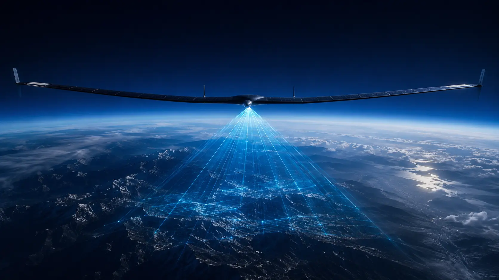

What are High-Altitude Pseudo-Satellites (HAPS)?
High-Altitude Pseudo-Satellites (HAPS) are solar-electric, unmanned aircraft that operate in the stratosphere—typically around 60,000 feet—for months at a time. They bridge the gap between satellites and terrestrial cell towers by functioning as stationary aerial platforms to beam broadband internet and conduct persistent Earth observation.
At a Glance
- Concept: Utilizing ultra-lightweight, fixed-wing drones or airships powered by solar energy to loiter in the stratosphere, providing regional connectivity and surveillance without entering outer space.
- Why it matters: Connecting the remaining unconnected populations using physical cell towers is geographically and economically impossible. Launching Low-Earth Orbit (LEO) satellites is immensely expensive. HAPS provides a rapidly deployable, reusable alternative that costs a fraction of a rocket launch.
- Who uses it: Telecommunications giants (like SoftBank and NTT DOCOMO), defense agencies requiring persistent border surveillance, and aerospace innovators like Airbus subsidiary AALTO and BAE Systems.
- Biggest takeaway: The commercial viability of HAPS has officially arrived in 2026, unlocked by next-generation silicon-anode batteries that allow these aircraft to survive the freezing, sunless stratospheric night without losing power.
In Simple Words
If you want to get cell phone service to a remote village or track a ship across an ocean, you currently have two options: build a cell tower on the ground, or launch a satellite into space.
Cell towers only cover a tiny area, and building them in mountains or jungles is incredibly difficult. Satellites cover massive areas, but launching them requires multi-million-dollar rockets, and they orbit so fast that they only pass over a specific area for a few minutes a day.
High-Altitude Pseudo-Satellites (HAPS) are the “Goldilocks” solution.
Imagine a drone with the wingspan of a commercial airliner, but it weighs less than an adult human. Covered entirely in solar panels, this drone takes off and flies to 60,000 feet—twice as high as normal airplanes, putting it above all weather and clouds. Once it gets there, it simply flies in a slow, continuous circle for months at a time. To the people on the ground, it acts exactly like a 12-mile-high cell tower that never moves, beaming high-speed internet down to a massive area for a fraction of the cost of going to space.
Why This Matters
The rollout of global 5G and early 6G networks has encountered a severe geographical bottleneck.
Telecommunications carriers cannot justify the Capital Expenditure (CapEx) of laying fiber-optic cables and building macro towers in sparsely populated rural zones. Consequently, the digital divide remains stubbornly wide. HAPS fundamentally alters the economics of rural telecommunications. A single stratospheric platform can cover the area typically served by approximately 50 terrestrial macro cell towers.
For defense and intelligence agencies, HAPS fulfills a critical operational gap: persistent surveillance. A military satellite can take a high-resolution photo of a target, but the satellite moves out of range within minutes. A HAPS platform can loiter over a single target—like a contested border or a naval chokepoint—for 60 straight days, providing uninterrupted, real-time streaming video without the massive fuel and crew costs of flying traditional reconnaissance planes.
The Commercial HAPS Market in 2026
The HAPS industry is currently graduating from a decade of experimental aerospace engineering into a highly lucrative commercial market.
Valued at roughly USD 102 million to USD 140 million in 2026, the sector is experiencing rapid expansion as telecom operators embed HAPS nodes into their Non-Terrestrial Network (NTN) architectures. This market activation is being heavily accelerated by regulatory breakthroughs. In 2024, the United States officially opened the 47 GHz spectrum for HAPS operations, while the European Union anticipates full CEPT spectrum harmonization by 2027.
However, the airspace above 60,000 feet is no longer an unregulated “Wild West.” As fixed-wing UAVs (which control roughly 60 percent of the HAPS market share) begin permanent operations, national aviation authorities are scrambling to draft airworthiness and air-traffic management rules to prevent stratospheric collisions.
How High-Altitude Pseudo-Satellites Work
Achieving persistent flight at the edge of space requires defeating the punishing physics of the stratosphere. Here is the first-principles breakdown.
1. The Fundamental Problem: Sustained Station-Keeping
To act as a cell tower, an aircraft must loiter over a specific geographic coordinate continuously. Standard aircraft use jet fuel, meaning they must land every few hours to refuel. Satellites use orbital mechanics (gravity and velocity) to stay aloft without fuel, but they are incredibly expensive to place in orbit and cannot be easily recalled for maintenance.
2. The Insufficiency of Traditional Drones
Standard unmanned aerial vehicles (UAVs) fly in the troposphere (where weather occurs). They are subjected to intense winds, clouds, and storms, which drain their batteries rapidly as they fight turbulence and lose solar exposure.
3. The Core Mechanism: Stratospheric Solar-Electric Flight
HAPS platforms bypass weather entirely by ascending to the stratosphere (roughly 20 kilometers or 65,000 feet). At this altitude, there are no clouds, ensuring 100 percent solar irradiance during the day. The aircraft is designed with an extreme aspect ratio (long, thin wings covered in ultra-lightweight photovoltaics). During the day, the solar panels power the electric propellers and simultaneously charge an onboard battery bank.
4. Technical Depth: The Battery Bottleneck and Silicon Anodes
The greatest engineering challenge of a HAPS is surviving the night. The aircraft must run its propellers and heavy telecommunications payload using only battery power for 12 hours of darkness at ambient temperatures of -70°C. Standard lithium-ion batteries are too heavy; adding enough batteries to survive the night makes the aircraft too heavy to climb. The 2025/2026 breakthrough relies on Silicon-Anode Batteries. Companies like Amprius developed cells delivering an exceptional 450 Watt-hours per kilogram (Wh/kg)—a 40 percent leap over conventional lithium packs. This immense energy density allows the drone to carry a high-power 5G payload through the night without losing altitude.
5. Real-World Consequences: Non-Terrestrial Networks (NTN)
Once stationed, the HAPS integrates directly into global telecom grids using the 3GPP Non-Terrestrial Network (NTN) standard. The drone communicates with a ground station via a high-frequency optical or millimeter-wave feeder link. It then broadcasts a standard 5G signal downward. Because the signal originates from directly overhead, it bypasses the mountains and trees that block terrestrial cell towers, connecting directly to a standard, unmodified smartphone in a user’s hand.
Real-World Applications
Following successful prototypes, the 2026 landscape is defined by aggressive commercial and military deployments.
Direct-to-Device Telecom in Emerging Markets: In March 2025, Space Compass (a joint venture of NTT DOCOMO and SKY Perfect JSAT) utilized an Airbus AALTO Zephyr to execute a massive trial in Kenya. Flying continuously, the Zephyr successfully served 1,000 simultaneous users across a 140-kilometer radius, confirming the commercial viability of providing high-speed mobile internet directly to unmodified smartphones in deep rural regions without laying a single mile of fiber-optic cable.
Border and Maritime Surveillance (ISR): Defense agencies represent nearly 47 percent of the end-user market. BAE Systems integrated a Synthetic Aperture Radar (SAR) into its PHASA-35 stratospheric drone. Unlike optical cameras, SAR can see through clouds and operate at night. By loitering over a maritime border for a month, the platform provides naval commanders with a persistent, unblinking eye to track illegal fishing fleets, smugglers, and hostile submarine deployments at a fraction of the cost of a crewed P-8 Poseidon patrol.
Disaster Response and Environmental Monitoring: When hurricanes or earthquakes destroy terrestrial cell towers, restoring communication is a matter of life and death. HAPS platforms can be flown into the disaster zone within hours, instantly establishing an “umbrella” of 5G connectivity for first responders. Furthermore, companies like Sceye are utilizing civil contracts to track methane emissions and monitor forest fires in real-time using high-resolution thermal cameras.
Economic & Strategic Impact
The deployment of HAPS is creating a new, highly competitive tier in the aerospace economy.
Financially, the appeal is absolute. The Capital Expenditure (CapEx) to build and deploy a single HAPS platform ranges from USD 10 million to USD 50 million. In stark contrast, launching and replenishing a Low-Earth Orbit (LEO) satellite constellation (like Starlink or Project Kuiper) requires USD 500 million to USD 5 billion in capital. Furthermore, when a HAPS platform requires hardware upgrades—such as installing a faster 6G antenna—the operator simply lands the drone, swaps the payload, and relaunches it. A satellite is marooned in space forever.
Strategically, Japan is positioning itself as the undisputed leader of the HAPS telecommunications sector. Propelled by the geographical challenges of covering thousands of remote islands, consortiums led by SoftBank (HAPSMobile) and NTT DOCOMO have heavily invested in the technology, targeting comprehensive commercial domestic service across Japan by late 2026.
Advantages of HAPS vs. LEO Satellites
- Fractional Cost Profile: Eliminates the exorbitant costs of rocket launches, orbital space debris mitigation, and terrestrial cell tower land acquisitions.
- Upgradability and Reusability: Unlike LEO satellites, HAPS aircraft can be landed, maintained, upgraded with modern processors, and redeployed continuously.
- Zero Latency Lag: Because a HAPS flies at an altitude of 20 kilometers, the signal delay (latency) is negligible compared to satellites orbiting at 500+ kilometers, ensuring seamless voice calls and video streaming.
- Minimal Environmental Impact: Powered entirely by solar-electric systems, fixed-wing HAPS generate zero carbon emissions during operation, satisfying strict corporate ESG mandates.
Limitations
- Stratospheric Wind Shear: While weather is minimal at 60,000 feet, sudden, unpredictable stratospheric wind currents can overpower the drone’s lightweight electric motors, pushing it off-station or threatening its structural integrity.
- Payload Weight Constraints: Fixed-wing HAPS are incredibly fragile. To remain buoyant in the thin stratospheric air, payload weight is fiercely restricted (often under 150 lbs), limiting the size of the telecommunications antennas or radar dishes they can carry.
- Regulatory Airspace Backlogs: Integrating autonomous vehicles that fly for 60 days into civilian airspace is a regulatory nightmare. Operators face multi-year backlogs attempting to secure airworthiness certifications and navigate overlapping national aviation jurisdictions.
Common Misconceptions
Misconception: HAPS are just spy balloons or blimps.
Reality: While stratospheric airships (lighter-than-air) are a subset of the market (projected to grow at a 25.45% CAGR), nearly 60 percent of the commercial revenue is driven by fixed-wing, solar-electric drones like the Airbus Zephyr. These look and maneuver like massive, ultra-light gliders, not balloons.
Misconception: HAPS fly in outer space.
Reality: HAPS fly in the stratosphere, roughly 12 to 15 miles (20 kilometers) above the Earth. Outer space, defined by the Kármán line, does not begin until 62 miles (100 kilometers) up. HAPS still rely on air passing over their wings to generate lift.
Misconception: You need a special satellite phone to connect to them.
Reality: Modern HAPS are designed as Direct-to-Device (D2D) platforms. The drone broadcasts a standard 4G LTE or 5G signal that connects directly to the unmodified smartphone already sitting in your pocket.
What Most People Miss
The impact of Dual-Payload Economics.
A telecom carrier launching a HAPS to beam 5G internet is fundamentally limited by the subscription revenue they can generate from rural users. What most people miss is that a HAPS can carry two payloads simultaneously.
While the bottom of the drone points a 5G antenna at the ground, a secondary optical or thermal camera can be mounted alongside it. Companies are realizing they can subsidize the cost of bringing the internet to remote regions by simultaneously selling the high-resolution Earth-observation data (like live maritime tracking or agricultural crop monitoring) to defense contractors, hedge funds, and civil governments. This blended business model fundamentally alters the profitability timeline for stratospheric networks.
Comparison Table
| Feature | Terrestrial Cell Tower | LEO Satellite (e.g., Starlink) | Fixed-Wing HAPS (e.g., Zephyr) |
|---|---|---|---|
| Altitude | Ground Level (100-300 ft) | 500+ Kilometers | ~20 Kilometers (60,000+ ft) |
| Coverage Area | Very Small (~10 km radius) | Global (Constellation) | Regional (~7,500 sq km per drone) |
| Deployment Speed | Months/Years (Zoning, Fiber) | Years (Rocket manifests) | Days / Hours (Runway launch) |
| Hardware Upgradability | Easy | Impossible (Burns up on reentry) | Easy (Lands for maintenance) |
| Latency | Near-Zero | Low (~20-40 ms) | Near-Zero |
| Capital Expenditure | Low (Per Tower) | Extreme (Billions) | Moderate ($10M – $50M per platform) |
Case Study
Situation: In the early 2020s, aerospace engineers proved that solar-electric drones could reach the stratosphere, but achieving true “persistence”—surviving multiple nights without landing—remained elusive. The batteries were simply too heavy.
Challenge: AALTO, a subsidiary of Airbus, needed to prove that their Zephyr platform could serve as a continuous commercial telecom node. To do so, they needed to dramatically decrease battery weight while increasing energy storage to survive the long, freezing stratospheric nights.
Solution (The Amprius Integration): AALTO partnered with Amprius Technologies to outfit the Zephyr with a next-generation silicon-anode battery pack. Replacing traditional graphite, the silicon anodes delivered an unprecedented energy density of 450 Wh/kg.
Outcome: In May 2025, powered by the advanced silicon-anode cells, the AALTO Zephyr shattered aviation records by executing a continuous, 67-day stratospheric flight. The drone maintained altitude flawlessly through over two months of day/night cycles, proving that the energy storage bottleneck had been conclusively solved.
Lessons Learned: The 67-day milestone signaled a permanent paradigm shift to the telecommunications industry. It validated that HAPS is no longer a localized science experiment; it is a reliable, semi-permanent infrastructure asset. By leveraging cutting-edge material science (silicon anodes), AALTO proved that the commercialization of the stratosphere is bounded only by regulatory approval, not technological feasibility.
Future Outlook
Next 12–24 Months
The era of the Commercial Rollout. Following their successful 2024 and 2025 technology demonstrations (including 38 GHz millimeter-wave connectivity), Japanese conglomerates like SoftBank’s HAPSMobile will launch the world’s first fully commercial stratospheric 5G networks by late 2026. Simultaneously, defense agencies will heavily ramp up procurement, utilizing platforms like the Zephyr and PHASA-35 for uninterrupted border surveillance amidst rising geopolitical tensions.
Next 3–5 Years
The Regulatory Standardization of the Stratosphere. Currently, flying a drone for months at a time requires case-by-case waivers from aviation authorities, creating massive bottlenecks. By 2028, entities like the FAA and the European Union Aviation Safety Agency (EASA) will finalize unified airspace integration rules. We will see the establishment of dedicated “stratospheric corridors” that dictate exactly how HAPS safely ascend through commercial airline traffic to reach their 60,000-foot operating zones.
Next 10 Years
The Airship Renaissance and 6G Networks. As the 2030s begin, fixed-wing drones will be joined by massive, lighter-than-air stratospheric airships (which are forecast to expand rapidly at a 25.45% CAGR). Because airships rely on helium buoyancy rather than aerodynamic lift, they can carry vastly heavier payloads. These heavy-lift airships will serve as the backbone for early 6G network integration, carrying massive optical-laser communication arrays capable of shuttling terabytes of data between LEO satellites and the ground at the speed of light.
Most Likely Scenario
HAPS will not replace LEO satellite constellations like Starlink; they will seamlessly integrate with them. Telecom operators will construct a three-tiered internet: ground towers for dense cities, HAPS for persistent regional coverage in rural and suburban zones, and LEO satellites for oceans and the deepest global connectivity. The stratosphere will evolve into a heavily trafficked, multi-billion-dollar logistics and data corridor, quietly hovering just out of sight.
Key Takeaways
- High-Altitude Pseudo-Satellites (HAPS) operate in the stratosphere (~60,000 feet) to provide 5G connectivity and persistent surveillance for months at a time.
- Fixed-wing UAVs command roughly 60% of the HAPS market, utilizing ultra-lightweight frames and massive solar arrays to power electric flight.
- The most critical engineering challenge—surviving the sunless stratospheric night—was successfully resolved using 450 Wh/kg silicon-anode batteries, leading to a record 67-day continuous flight by the Airbus Zephyr in 2025.
- A single HAPS platform costs a fraction of a satellite launch (USD 10M-50M) and can cover a telecommunications footprint equivalent to approximately 50 terrestrial macro cell towers.
- Dual-payload missions allow operators to beam 5G internet while simultaneously conducting high-resolution military or environmental Earth observation.
- Major commercial services are targeting full deployment by late 2026, spearheaded by telecom giants in Japan operating under newly opened high-frequency spectrum allocations.
Glossary
3GPP (3rd Generation Partnership Project): The global organization that develops the protocols for mobile telecommunications, currently heavily focused on integrating space and stratospheric drones into standard 5G networks.
Direct-to-Device (D2D): The capability of a satellite or HAPS platform to beam a cellular signal directly to a standard, unmodified commercial smartphone, eliminating the need for a specialized satellite dish.
HAPS (High-Altitude Pseudo-Satellite): An unmanned aircraft (drone or airship) that operates in the stratosphere for extended periods to provide telecommunications and Earth observation services.
Non-Terrestrial Network (NTN): A communications network that uses spaceborne vehicles (satellites) or airborne vehicles (HAPS) as relay nodes, seamlessly extending standard terrestrial cellular networks.
Silicon-Anode Battery: An advanced lithium-ion battery that replaces the graphite anode with silicon, drastically increasing energy density (Wh/kg) and enabling HAPS to survive the stratospheric night.
Synthetic Aperture Radar (SAR): A sophisticated form of radar used to create 2D images or 3D reconstructions of landscapes. Unlike optical cameras, SAR can “see” perfectly through clouds and pitch darkness.
Frequently Asked Questions
Are HAPS the same as the internet balloons Google tried to make?
No. Google’s “Project Loon” utilized unpowered, free-floating stratospheric balloons that drifted unpredictably with the wind, making continuous coverage nearly impossible. The modern HAPS market is dominated by powered, navigable fixed-wing aircraft that can actively maintain a stationary position (station-keeping) against high-altitude winds.
Why don’t commercial airplanes fly as high as HAPS?
Commercial airliners generally fly between 30,000 and 40,000 feet. The air at 60,000 feet is so thin that standard jet engines cannot draw enough oxygen to burn their fuel, and heavy aircraft cannot generate enough lift. HAPS solve this by being incredibly lightweight and using electric motors powered by the sun.
Do you need a special phone to connect to a HAPS?
No. Because they fly relatively close to the Earth compared to satellites, HAPS can broadcast standard 4G LTE and 5G signals. An unmodified smartphone sitting in your pocket will automatically connect to a HAPS just like it connects to a normal cell tower.
What happens if a HAPS breaks down over a city?
HAPS operators map out strict, remote loitering zones and descent paths. Because fixed-wing HAPS are essentially giant gliders, a complete loss of motor power does not cause them to plummet like a rock. They will slowly glide down over the course of hours, allowing operators to steer them safely to unpopulated recovery zones.
Are HAPS cheaper than satellites?
Significantly. Building and deploying a LEO satellite constellation requires hundreds of millions, if not billions, of dollars and relies on heavy-lift rockets. A HAPS platform costs roughly USD 10 million to USD 50 million, can take off from a standard runway, and can be landed and repaired if a component breaks.
Sources
[1] Mordor Intelligence: High Altitude Pseudo Satellites Market Report 2031 (February 2026)
[2] Airbus / AALTO: Zephyr High Altitude Platform Station (HAPS) Earth Observation
[3] Fortune Business Insights: High-Altitude Pseudo Satellites Market Size, Share, Growth 2034 (July 2026)
[4] HAPS Alliance: Media Coverage – SoftBank and partners to develop optical wireless communication (2026)