Advertisement
)

AT A GLANCE
- Concept: Gravitational Equilibrium: Points in space where the gravity of the Earth and the Moon perfectly cancel each other out.
- Concept: The High Ground: Satellites parked at these coordinates maintain continuous, unblocked line-of-sight across the entire cislunar volume.
- Concept: Fuel Economics: Station-keeping at these gravitational nodes requires almost zero propellant, extending operational lifespans indefinitely.
- Concept: The Exclusion Zone: Earth-based radars are blinded by the sun or the moon’s glare, making deep-space orbital outposts physically mandatory.
HOW A CISLUNAR LAGRANGE POINT WORKS
The vacuum of space is not a flat, empty void; it is a complex, invisible topography of gravitational hills and valleys. When a satellite operates near Earth, it must constantly fight terrestrial gravity, moving at thousands of miles per hour simply to stay in orbit. The physics change completely when you push out 385,000 kilometers toward the Moon into cislunar space.
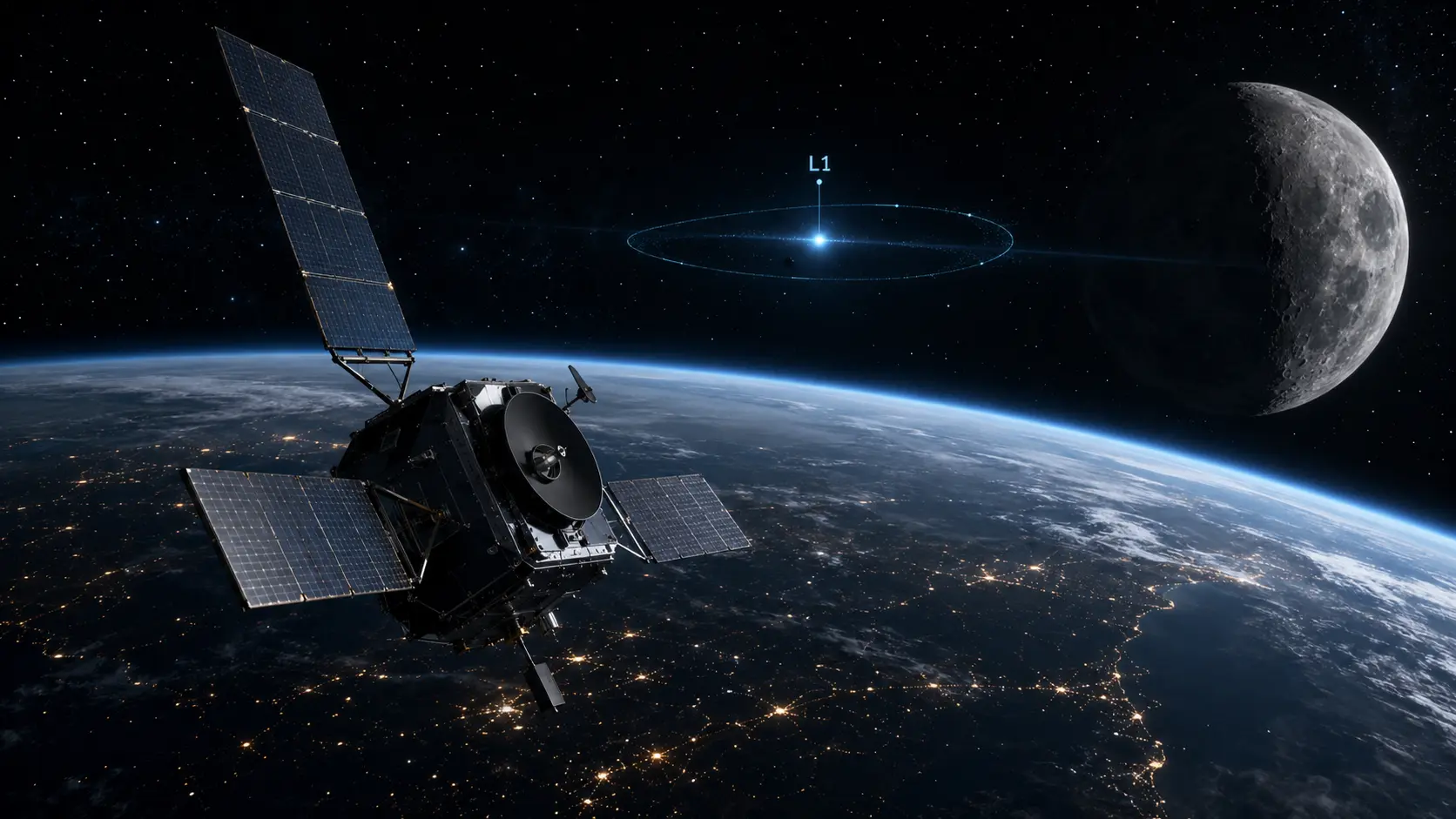
Between any two massive orbiting bodies—like the Earth and the Moon—there exist five distinct gravitational anomalies known as Lagrange points (L1 through L5). At these exact mathematical coordinates, the gravitational pull of the Earth perfectly equals the gravitational pull of the Moon, combined with the centripetal force required to orbit with them.
If the United States Space Force places a surveillance satellite, such as the Oracle-Prime system, directly into a halo orbit around the L1 or L2 Lagrange point, the spacecraft physically locks into this equilibrium. It does not fall toward the Earth, and it does not fall toward the Moon. The satellite simply floats in perfect synchronization with the lunar orbit.
Because the gravitational forces cancel each other out, the satellite requires a fraction of the chemical propellant (Δv) to maintain its position compared to standard orbits. From this stable vantage point, the satellite’s narrow-field sensors can peer outward or downward, maintaining an uninterrupted, continuous stare across the entire volume of cislunar space without ever having its view blocked by the physical mass of the Earth.
WHY IT MATTERS NOW
For six decades, global military operations extended only to Geosynchronous Earth Orbit (GEO), roughly 36,000 kilometers above the equator. Today, the strategic domain has violently expanded outward to encompass the entire volume of space between the Earth and the Moon.
Adversarial nations like China are actively launching lunar relay satellites and robotic exploration missions to the lunar south pole. If a foreign military launches an “inspector” satellite or an anti-satellite weapon into deep cislunar space, terrestrial radar systems physically cannot track it. Earth-based optical telescopes are frequently blinded by atmospheric distortion, solar glare, and the physical blockage of the Moon itself, known as the lunar exclusion zone.
This physical blindness created a massive tactical vulnerability. An adversary could theoretically park a kinetic weapon on the dark side of the Moon, perfectly hidden from Earth, and launch a stealth trajectory attack against critical American early-warning satellites in GEO.
To close this blind spot, the US Space Force established dedicated deep-space surveillance programs like the Cislunar Highway Patrol System (CHPS) and the Oracle Family of Systems. By occupying the Lagrange points, the military establishes the ultimate gravitational high ground. These orbital outposts act as unassailable watchtowers, utilizing advanced Space Domain Awareness (SDA) algorithms to detect, track, and mathematically predict the trajectory of any unidentified object traveling through the lunar corridor.
WHAT MOST PEOPLE MISS
Commercial space reporting focuses heavily on the economics of mining lunar ice or launching space tourism flights. They completely miss the reality that Lagrange points are physically finite, incredibly small volumes of orbital real estate.
Because they offer such extreme fuel advantages for station-keeping and deep-space communications, $L_1$ and $L_2$ function as the natural deep-space chokepoints of the twenty-first century. Just as the British Empire historically controlled maritime trade by physically occupying the Strait of Gibraltar and the Suez Canal, modern superpowers are racing to legally and physically occupy the Earth-Moon Lagrange points, realizing that whoever controls these gravitational nodes inherently controls the logistics of the entire cislunar economy.
THE TRAJECTORY
Next 12–36 Months: The United States Space Force will activate the Oracle-Prime satellite network, officially extending the military’s sensor architecture tenfold beyond traditional GEO limits and establishing the first permanent military footprint in the cislunar regime.
Next Five Years: The rapid militarization of $L_4$ and $L_5$. These two Lagrange points are mathematically stable, meaning objects naturally clump there without any fuel consumption. Militaries will begin deploying autonomous logistical supply depots and dormant weapon platforms to these coordinates, keeping them perfectly hidden in deep space until activated during a conflict.
Next Ten Years: The establishment of heavily defended cislunar logistical hubs. Superpowers will build massive, crewed space stations at the $L_1$ point. These stations will act as the mandatory customs and refueling checkpoints for all commercial and military traffic transiting between the Earth’s gravity well and the lunar surface.
What Could Go Wrong: Orbital crowding and accidental collisions. Because the exact gravitational “sweet spot” of a Lagrange point is small, deploying multiple classified intelligence satellites from competing nations into the same halo orbit creates extreme navigational tension. A slight miscalculation in thruster management could trigger a high-speed collision in deep space, creating an international crisis where neither side can easily attribute fault.
Most Likely Outcome: Lagrange points will become the most fiercely contested strategic geography in the solar system. The gravitational physics of deep space dictate that occupying these specific coordinates is the absolute prerequisite for securing national defense and economic sovereignty beyond Earth orbit.
KEY TERMS
- Lagrange Point: A position in space where the gravitational forces of a two-body system produce enhanced regions of attraction and repulsion, allowing spacecraft to remain stationary with minimal fuel.
- Cislunar Space: The vast three-dimensional volume of space extending beyond Geosynchronous Earth Orbit out to the physical surface of the Moon.
- Space Domain Awareness (SDA): The comprehensive tracking and mathematical understanding of the physical location, capabilities, and intentions of all objects currently operating in orbit.
- Delta-v ($\Delta v$): A measure of the impulse needed to perform an orbital maneuver, representing a change in velocity; it physically dictates how much fuel a satellite must burn to change its orbit.
- Halo Orbit: A complex, three-dimensional orbital path that allows a spacecraft to continuously circle an invisible, empty Lagrange point without drifting away.
SOURCES
- Air Force Research Laboratory (AFRL) — The Oracle Family of Systems and Cislunar Space Domain Awareness
- United States Space Force (USSF) — Cislunar Coordination Office and Deep Space Navigation Architecture
- Johns Hopkins University Applied Physics Laboratory (JHU/APL) — Cislunar Security Conference Briefings and Orbital Mechanics
- Center for Strategic and International Studies (CSIS) — Defense Against the Dark Arts in Space: Protecting Space Systems from Counterspace Weapons