Advertisement
)
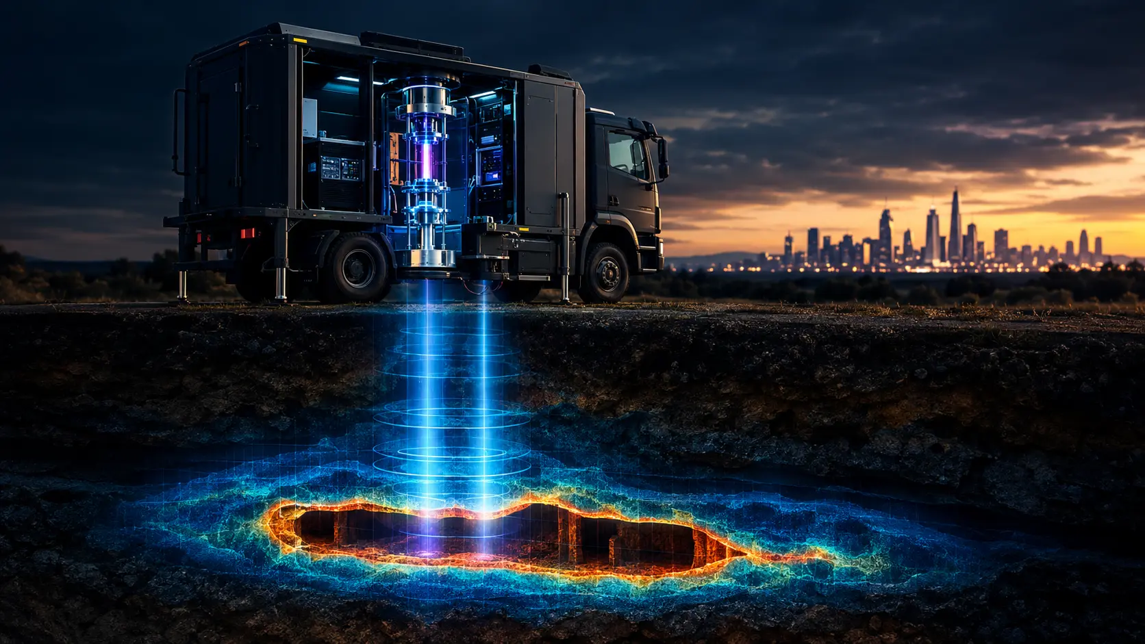

Imagine attempting to route a new high-speed rail line through an ancient city, or commanding a military unit tasked with locating a heavily fortified, deep-underground bunker. Historically, you had two options: drill blindly and hope you don’t hit a gas main, or use Ground-Penetrating Radar (GPR). GPR is notoriously fragile; it becomes completely blind past a few meters of wet clay or dense rock. The subterranean world is largely invisible, and mapping it is an exercise in expensive guesswork.
Why should you care right now? Because quantum physicists have successfully taken one of the most delicate laboratory experiments on Earth and ruggedized it for the back of a truck. By dropping clouds of freezing-cold atoms and measuring how gravity pulls on them, quantum sensors can perfectly map deep underground voids in milliseconds. This technology completely bypasses the limitations of radar and acoustic drilling. It allows defense strategists and civil engineers to literally “see” through solid rock using the fundamental force of gravity, unlocking the last unmapped domain on Earth.
What is Quantum Gravity Gradiometry?
Quantum gravity gradiometry is an advanced sensing technology that measures microscopic variations in Earth’s gravitational field to map subterranean structures. By using lasers to freeze and drop two clouds of rubidium atoms simultaneously, the system cancels out surface vibrations, revealing the exact location of underground tunnels, sinkholes, and bunkers.
At a Glance
- Concept: Using the physics of gravity, rather than radio waves, to see what is buried underground.
- Why it matters: Radio waves (radar) bounce off rocks and water. Gravity passes through everything. By reading gravity, you can map deep structures regardless of the soil type.
- Who uses it: Civil engineering firms, the defense intelligence community, and quantum spin-outs like Delta g (UK) and Exail (France).
- Biggest takeaway: A normal gravity sensor is ruined if a truck drives by, because the vibration shakes the sensor. A quantum gradiometer drops two clouds of atoms at once. The truck shakes both equally, perfectly canceling out the noise.
In Simple Words
Everything in the universe has mass, and everything with mass exerts gravity. Solid rock has a certain amount of mass. If there is a hollow tunnel running through that rock, there is less mass in that specific spot. Therefore, the gravity directly directly above the tunnel is fractionally weaker.
If you had a sensitive enough scale, you could walk across the ground and feel yourself get slightly lighter when you stepped over a hidden tunnel.
Quantum Gravity Gradiometry is that scale.
Instead of a mechanical spring, it uses atoms. Scientists use lasers to freeze a cloud of atoms and then let them fall. By measuring exactly how fast the atoms fall, they can measure the exact strength of gravity in that specific spot. It allows engineers to drive a truck over a field and print a flawless 3D map of the caves, pipes, and bunkers hidden hundreds of feet below the surface.
Why This Matters
For Defense Strategists, Quantum Physicists, and Infrastructure Planners, this technology solves the Subsurface Uncertainty Penalty.
In civil engineering, unforeseen ground conditions (like hidden sinkholes or unmapped historical utility lines) account for massive project delays. Up to 10% of major infrastructure budgets are routinely wasted simply dealing with subterranean surprises that radar failed to detect.
In the defense sector, the problem is lethal. Modern adversaries increasingly rely on Deep Underground Military Bases (DUMBs) and cross-border smuggling tunnels. Ground-penetrating radar cannot reach them, and satellite imagery can only see the surface entrances.
By commercializing quantum gravity sensors, we replace acoustic guessing with deterministic physics. Gravity cannot be jammed, spoofed, or blocked by lead shielding. If a hollow space exists underground, the local gravitational field must change. Quantum sensors make this fundamental law of physics readable, rendering deep-underground concealment practically impossible.
Micro-Insight: Radar measures what a material is (by how it reflects light). Gravimetry measures how much material there is (by its mass). This allows gravity sensors to easily distinguish between a solid rock and a hollow bunker wall.
The Applied Physics of Quantum Superposition
We are witnessing the Weaponization of Atomic Superposition.
Quantum mechanics is notoriously fragile. For decades, atom interferometry was confined to highly isolated, vibration-proof basements in university physics departments.
The transition of this technology from delicate lab experiments to ruggedized field equipment marks a critical inflection point. We are taking the strange, counter-intuitive properties of quantum superposition and turning them into deployable industrial hardware. The era of applied quantum sensing has officially arrived.
How Dual-Cloud Atom Interferometry Cancels Noise
Measuring a shift in gravity equivalent to one-billionth of Earth’s normal pull while sitting on the back of a vibrating truck requires absolute mastery over thermodynamics and quantum mechanics. Here is the first-principles breakdown of the architecture.
1. The Fundamental Problem: Seismic Noise
A classical gravimeter uses a mass on a highly sensitive spring. When gravity increases, the spring stretches. The problem is “equivalence.” Einstein’s equivalence principle states that gravity and acceleration are indistinguishable. If a truck drives past your sensor, the seismic vibration shakes the spring. The sensor cannot tell the difference between the truck’s vibration and a shift in gravity. The data becomes useless noise.
2. The Core Mechanism: Cold Atoms (2D/3D MOT)
To build a better spring, physicists use atoms. Inside an ultra-high vacuum chamber, they inject Rubidium gas. They hit the gas from all sides with highly tuned lasers. Because light has momentum, the lasers physically push against the atoms, slowing them down. This is called a Magneto-Optical Trap (MOT). The atoms slow to a near-standstill, dropping their temperature to a fraction of a degree above absolute zero.
3. Technical Depth: Atom Interferometry
Once the atoms are frozen, the lasers shut off, and the cloud of atoms begins to fall in free-fall. During the fall, laser pulses are used to split the atomic wave-functions into a state of quantum superposition—each atom literally travels along two different physical paths simultaneously before being recombined.
The gravity of the Earth pulls on these wave-functions. When they recombine, they create an interference pattern. By reading this pattern, physicists can measure the exact gravitational acceleration the atoms experienced with microscopic precision.
4. Technical Depth: The Gradiometer Configuration
To solve the truck vibration problem, engineers build a gradiometer. Instead of dropping one cloud of atoms, they stack two vacuum chambers on top of each other and drop two clouds of atoms simultaneously, separated by exactly one meter.
Plain-English Takeaway: A passing truck shakes both the top cloud and the bottom cloud equally. But a tunnel hidden in the dirt below pulls slightly harder on the bottom cloud than the top cloud. By subtracting the top reading from the bottom reading, the truck’s noise perfectly mathematically cancels out to zero, leaving only the pure signal of the hidden tunnel.
5. Real-World Consequences: Continuous Mapping
Because the atoms fall and are measured in a fraction of a second, the system can operate continuously. A utility vehicle equipped with a quantum gravity gradiometer can drive down a city street at 15 miles per hour. The dual-cloud system continuously drops atoms, cancels the road noise, and paints a high-contrast, real-time 3D map of the subterranean infrastructure below the pavement.
Quantum vs. Classical Gravity Mapping
Common-Mode Noise Rejection in Subterranean Void Detection
Surface Vibration Noise
High (Traffic)
Sensor Architecture
Classical Gravimeter
Quantum Dual-Cloud
Common-Mode Rejection
0.0%
Signal-to-Noise Ratio (SNR)
0.8 dB
Subterranean Detection Status
LOST IN NOISE
Terrain & Subsurface Sensor Physics
CLASSICAL SPRING SENSOR
Spatial Gravity Anomaly Map (Δg)
Commercial and Defense Deployments of Quantum Gradiometers
Quantum gravity sensing is moving out of the basement and into commercial deployment.
The Delta g Civil Engineering Platform: Spun out of the University of Birmingham, the UK-based startup Delta g is actively commercializing quantum gradiometers for the construction industry. Before digging the foundation for a skyscraper or tunnel boring for a subway, construction firms use the Delta g sensor to sweep the area. The sensor maps forgotten Victorian-era sewer lines and unstable bedrock, preventing catastrophic collapses and slashing the need for exploratory drill holes.
Deep Underground Target Identification: For the defense intelligence community, locating adversaries who have retreated underground is a paramount challenge. While satellite-based classical gravimetry can detect massive geological features, truck-mounted quantum gradiometers provide tactical, high-resolution maps of border smuggling tunnels and reinforced subterranean command bunkers, regardless of how much steel or concrete is shielding them.
Quantum GPS-Denied Navigation: Nuclear submarines currently rely on inertial guidance systems when submerged, which drift over time and require surfacing to sync with GPS. A quantum gravity gradiometer can map the gravitational topography of the ocean floor in real-time. By comparing this live gravity data against pre-recorded gravitational maps, a submarine can pinpoint its exact global position indefinitely, completely immune to enemy GPS jamming or satellite destruction.
The Economic Disruption of Subsurface Digitization
The core strategic consequence of quantum gravity sensing is the Obsolescence of Acoustic Drilling.
The mining, oil, gas, and civil engineering industries spend billions of dollars annually on exploratory drilling. You cannot know exactly what is underground until you physically drill a hole into it.
Quantum sensing digitizes the underground. By replacing expensive, slow, and destructive physical drilling with rapid, non-invasive gravitational scanning, the resource extraction and construction industries will experience a massive reduction in Capital Expenditure (CapEx) risk. Companies will only drill when they are mathematically certain of the subterranean geometry.
Advantages
- Total Penetration: Unlike radar, which is easily blocked by wet soil or conductive metals, gravity cannot be blocked or shielded. It penetrates all matter flawlessly.
- Vibration Immunity: The dual-cloud gradiometer setup naturally rejects common-mode seismic noise, allowing highly sensitive quantum measurements to take place in chaotic urban environments.
- Non-Invasive: Maps massive subterranean areas quickly without digging a single exploratory hole or disrupting local ecosystems.
- Passive Sensing: Unlike radar or sonar, which actively emit energy (giving away the user’s position), a gravity sensor is entirely passive. It only receives data, making it completely stealthy for military operations.
Limitations
- The SWaP Constraint: (Size, Weight, and Power). Currently, maintaining an ultra-high vacuum chamber and operating multiple precisely tuned cooling lasers requires a piece of equipment roughly the size of a refrigerator. It cannot yet be mounted on a small commercial drone.
- Slower Read Rates: While classical sensors take continuous readings, an atom interferometer must load atoms, cool them, drop them, and read them. This pulse-cycle takes a fraction of a second, which limits how fast the survey vehicle can drive while maintaining high-resolution mapping.
- The Inverse-Cube Law: The gravitational gradient of a void decays very rapidly over distance. While a gradiometer can easily spot a 10-meter bunker 50 meters down, spotting a 2-meter smuggling tunnel 200 meters down requires exponentially more sensitive atom cooling limits.
Takeaway: The physics are flawless, but the hardware is bulky. The entire industry is currently in a brutal engineering sprint to shrink a room full of lasers onto a microchip.
Common Misconceptions
Misconception: Gravity sensors use radio waves like a scanner.
Reality: They emit absolutely nothing. They are purely passive instruments. They simply measure the natural pull of the Earth beneath them.
Misconception: They can see the exact shape of an object.
Reality: They do not produce an optical photograph. They produce a density map. A buried gold bar (heavy) and a buried hollow pipe (light) both look like mathematical anomalies on a chart. Advanced software algorithms interpret these anomalies to infer the shape and composition of the object.
Misconception: Quantum sensors are decades away.
Reality: Commercial, truck-mounted quantum gradiometers are operating in the field today. The underlying science was proven in 2022; the current phase is pure commercial ruggedization and manufacturing scale.
What Most People Miss
The disruptive capability of Volcanic and Seismic Early Warning.
When analysts discuss gravity sensors, they focus on finding static things like tunnels or ore deposits. What they miss is dynamic fluid mapping.
Magma moving inside a volcano, or massive water tables shifting underneath a fault line, involve millions of tons of mass changing location in real-time. By deploying a permanent array of quantum gravity gradiometers around a high-risk geological zone, scientists can literally watch the mass of the magma rising through the Earth’s crust in real-time, potentially providing days or weeks of early warning before a catastrophic eruption or earthquake.
Comparison Table
| Feature | Ground-Penetrating Radar (GPR) | Classical Gravimetry | Quantum Gravity Gradiometry |
| Sensing Mechanism | Radio Wave Reflection | Mechanical Spring | Atom Interferometry |
| Penetration Depth | Shallow (Blocked by wet clay) | Deep | Deep (Unblockable) |
| Vibration Tolerance | High | Extremely Low (Ruined by noise) | Extremely High (Noise canceled) |
| Signal Type | Active (Emits energy) | Passive | Passive (Stealthy) |
| Form Factor | Handheld / Pushcart | Backpack / Vehicle | Van / Large Vehicle |
Future Outlook
Next 12–24 Months
The era of Civil Engineering Validation. Through 2026, companies like Delta g will execute lucrative contracts with municipal governments and rail operators. The primary focus is generating massive datasets of urban subterranean maps, proving to the insurance and construction industries that quantum scanning is vastly cheaper and more accurate than traditional risk-mitigation drilling.
Next 3–5 Years
The scaling of Photonic Integrated Circuits (PICs). By 2029, the massive optical benches full of mirrors and lenses used to guide the cooling lasers will be obsolete. The industry will transition to Photonic Integrated Circuits—printing the lasers directly onto silicon chips. This breakthrough will slash the size, weight, and power (SWaP) of the sensors by 80%, allowing them to be mounted directly onto medium-altitude military drones for rapid, unmanned battlefield scanning.
Next 10 Years
The Quantum Navigation Standard. By the 2030s, the reliance on easily jammed GPS satellites for critical defense infrastructure will end. Every nuclear submarine, strategic bomber, and autonomous heavy transport will carry a miniaturized quantum gravity sensor. By reading the unique gravitational fingerprint of the Earth beneath them, these assets will navigate the globe with perfect accuracy in total electronic silence.
Most Likely Scenario
Quantum gravity gradiometry is the definitive solution to subsurface mapping and GPS-denied navigation. While early commercial units face significant SWaP constraints, the trajectory of laser miniaturization ensures these devices will rapidly shrink. By flawlessly eliminating seismic noise through dual-cloud interferometry, quantum sensors have permanently cracked the code of the underground, making true subterranean concealment a relic of the past.
Key Takeaways
- Traditional tools like ground-penetrating radar are easily blocked by dense dirt and water, making it incredibly difficult to map underground structures.
- Underground tunnels and bunkers represent a lack of mass, which creates a microscopic dip in the local gravitational field directly above them.
- Classical gravity sensors are ruined by vibrations (like passing trucks), rendering them useless in cities or battlefields.
- Quantum gravity gradiometers solve this by dropping two clouds of freezing-cold atoms simultaneously. Since a truck shakes both clouds equally, the noise cancels out, leaving only the pure gravity signal of the hidden tunnel.
- This technology is actively being commercialized to prevent construction collapses, locate military bunkers, and allow submarines to navigate perfectly without relying on GPS.
Glossary
Atom Interferometry: A quantum technique that uses lasers to split an atom’s wave-function along two paths and recombine them, allowing scientists to measure highly precise gravitational forces based on the resulting interference pattern.
Common-Mode Rejection: A mathematical principle where noise affecting two sensors equally (like a vibrating truck) is canceled out by subtracting the reading of one sensor from the other.
Gradiometer: An instrument that measures the difference (gradient) in a physical property (like gravity) between two separate points, rather than just measuring the absolute value at a single point.
Magneto-Optical Trap (MOT): A device that uses a combination of magnetic fields and perfectly tuned lasers to push against atoms, slowing them down and cooling them to near absolute zero.
Rubidium: A soft, silvery-white metallic element frequently used in quantum sensors and atomic clocks because its atomic structure interacts very predictably with laser light.
SWaP (Size, Weight, and Power): A critical engineering metric in the aerospace and defense industries denoting how large, heavy, and power-hungry a piece of equipment is.
Sources
Nature: Quantum gravity gradiometer outside the laboratory
University of Birmingham (UK Quantum Technology Hub): Mapping the Underworld with Cold Atoms
Delta g: Commercializing Quantum Gravity Sensors for Civil Engineering
Exail: Absolute Quantum Gravimetry and Atom Interferometry
Department of Defense (DoD): Quantum Sensing for Subterranean Target Detection and GPS-Denied Navigation