Advertisement
)

AT A GLANCE
- Concept: Geolocation: Pinpointing the exact geographic coordinates of a photo or video using physical landmarks.
- Concept: Ephemeris Data: The precise mathematical calculation of a satellite’s position in orbit at a specific time.
- Concept: Multispectral Imaging: Satellite cameras that capture light invisible to humans to detect hidden military assets.
- Concept: Synthetic Aperture Radar (SAR): Radar technology that peers through thick clouds and darkness to map the ground.
IN SIMPLE WORDS
For the entire Cold War, spying on a foreign military required a multi-billion dollar intelligence agency. Only superpowers could afford to launch spy satellites and deploy physical agents to track troop movements or hidden weapons facilities.
Today, that monopoly is gone. Anyone with an internet connection can access high-resolution commercial satellite photos, open maritime shipping transponders, and public flight radars. When a soldier posts a photo on social media, independent researchers can analyze the shape of the mountains in the background and the angle of the sun’s shadows. They match these details with public satellite maps to calculate the exact GPS coordinates of a secret military base.
This is Open Source Intelligence. It is the practice of piecing together massive amounts of scattered, public digital crumbs to expose covert operations in real time. It has turned global espionage into a decentralized, crowdsourced effort that hostile governments can no longer control or hide from.
HOW OPEN SOURCE INTELLIGENCE WORKS
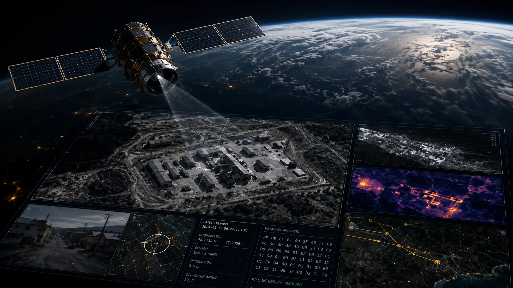
The mechanics of modern OSINT rely on cross-referencing multiple layers of digital data to establish undeniable proof. The foundation of this verification process is ephemeris data cross-referencing. When an investigator receives a commercial satellite image showing a hidden military base, they must verify its authenticity. They calculate the exact orbital path of the commercial satellite on that specific date and time to confirm the satellite was physically over the target coordinates when the image was supposedly taken.
Once the time and space are verified, analysts move to the visual spectrum. Military forces frequently use camouflage netting to hide tanks and artillery from normal optical cameras. OSINT researchers bypass this by purchasing multispectral imagery. These commercial satellites capture near-infrared bands of light. Because living vegetation reflects infrared light differently than synthetic green camouflage netting, the hidden military vehicles stand out as glowing anomalies against the natural forest.
Weather presents a significant physical obstacle, as optical cameras cannot see through dense cloud cover. To maintain constant surveillance over highly active conflict zones, researchers utilize Synthetic Aperture Radar (SAR). Commercial SAR satellites bounce microwave radar pulses off the Earth’s surface. These pulses easily penetrate clouds and total darkness, returning a detailed topographical map of metal structures, naval ships, and moving vehicle convoys regardless of the weather.
Finally, the integrity of the data itself must be mathematically proven to prevent state-sponsored deception. Investigators scrutinize the cryptographic metadata embedded inside digital photos and videos. They check the hex code structure and error-level analysis to determine if an image was digitally manipulated in Photoshop. By chaining these independent data sets together—orbital paths, radar, multispectral light, and file metadata—a single investigator working from a laptop can mathematically prove a war crime that a government is actively trying to deny.
REAL WORLD EXAMPLE
The independent investigative collective Bellingcat famously demonstrated the absolute power of OSINT during the downing of Malaysia Airlines Flight 17 over Ukraine in 2014. The Russian government denied any involvement and presented doctored satellite imagery claiming the missile was fired by Ukrainian forces.
Bellingcat researchers bypassed the official state narrative entirely. They scraped social media platforms for dashcam footage and smartphone photos posted by ordinary civilians driving through eastern Ukraine. By analyzing the background buildings, road signs, and street layouts in these random photos, they geolocated the exact path of the Russian Buk missile launcher. They successfully tracked the weapon crossing the border from Russia, moving to the launch site, and returning to Russia missing a single missile, definitively proving state involvement using nothing but public data.
WHY IT MATTERS NOW
The democratization of remote sensing has permanently altered the fog of war. Historically, a nation could quietly mass an invasion force on a border and launch a surprise attack under the cover of darkness. The defending nation relied entirely on its own limited spy satellites or allied intelligence to spot the buildup.
Today, commercial space companies like Planet Labs and Maxar Technologies operate massive constellations of cheap, low-orbit satellites taking daily photos of the entire planet. Anyone with a credit card can purchase a high-resolution image of a sensitive border crossing. This forces military planners to assume that their most covert movements are always being watched and broadcast to the public internet in near real-time.
This massive public data layer also strips away plausible deniability. When authoritarian regimes deny human rights abuses, independent researchers use thermal satellite data to detect the heat signatures of burning villages. They use commercial ship tracking data (AIS) to expose massive, illegal oil transfers occurring in the middle of the ocean between sanctioned nations.
However, this reliance on commercial platforms introduces a severe geopolitical vulnerability. Because private corporations own these satellites, corporate executives now hold the power to blackout intelligence over specific regions. If a commercial satellite provider decides to stop selling imagery of a specific conflict zone to protect their local business interests, the entire OSINT community goes instantly blind.
COMMON MISCONCEPTIONS
- “OSINT means hacking into secure systems.” It is the exact opposite. Open source intelligence relies strictly on data that is legally and publicly available on the open internet, requiring zero hacking or password theft.
- “Only governments have high-quality satellites.” Commercial companies now launch satellites with resolutions sharp enough to identify the make and model of a truck on the ground, rivaling the capabilities of older classified spy satellites.
- “Removing GPS tags makes a photo untraceable.” Even if the internal metadata is scrubbed, OSINT investigators can geolocate a photo simply by analyzing the shape of the clouds, the angle of the shadows, and the unique architecture of buildings in the background.
WHAT MOST PEOPLE MISS
Analysts focus heavily on finding the hidden truth, but they frequently overlook the rising threat of “data poisoning.”
As intelligence agencies realize they can no longer hide from OSINT, they are actively polluting the open source environment. State actors deploy automated bots to flood social media with thousands of highly realistic, AI-generated images of fake troop movements or fabricated satellite coordinates. The goal is no longer to hide the truth, but to drown the small community of OSINT researchers in so much synthetic noise that verifying real data becomes computationally impossible.
THE ECONOMIC AND STRATEGIC IMPACT
The primary financial beneficiaries are the commercial space and data brokerage industries. Companies providing synthetic aperture radar and multispectral satellite imagery are securing massive contracts. Media organizations, hedge funds tracking global oil storage, and government agencies are all paying steep premiums for immediate access to raw planetary data.
Strategically, the intelligence community is undergoing a massive cultural shift. Traditional spy agencies historically dismissed public data, preferring classified sources. Today, organizations like the CIA and MI6 heavily rely on commercial OSINT to complement their classified intelligence. By using public data, governments can declassify and share threat warnings with allies and the public without burning their highly sensitive, covert human sources.
The absolute losers are nations reliant on extreme secrecy and isolation. The ability to hide internment camps, illegal nuclear enrichment facilities, or covert military deployments is vanishing. Sovereign borders cannot physically block a commercial satellite orbiting at 500 kilometers above the atmosphere.
THE TRAJECTORY
Next 12–36 Months: The integration of automated artificial intelligence into OSINT workflows. Instead of humans manually scanning thousands of satellite photos for changes, machine vision algorithms will autonomously flag new military trenches or missile silos the minute a commercial satellite beams the photo to Earth.
Next Five Years: The explosion of hyper-local commercial radar constellations. Dozens of private companies will deploy massive swarms of cheap SAR satellites, providing continuous, 24-hour, all-weather tracking of every major naval vessel and military base on the planet, eliminating the concept of operational darkness.
Next Ten Years: The battle of deepfake verification. As generative video reaches perfect photorealism, OSINT platforms will shift entirely toward cryptographic verification. Images and videos will only be trusted if the physical camera embedded a secure, blockchain-verified cryptographic hash into the file at the exact millisecond of capture.
What Could Go Wrong: A coordinated kinetic attack on commercial space infrastructure. If a major superpower feels that private OSINT companies are providing critical targeting data to their enemies during a war, they may designate those commercial satellites as valid military targets. Shooting down private civilian satellites would spark a massive, unprecedented crisis in international space law.
Most Likely Outcome: Open source intelligence will become the dominant, universally accepted baseline of global truth. The commercial space sector will effectively function as an independent, decentralized intelligence agency, permanently exposing the covert actions of hostile states to the public internet.
KEY TERMS
- Open Source Intelligence (OSINT): The collection and analysis of data gathered from publicly available sources to produce actionable intelligence.
- Geolocation: The precise process of determining the physical, real-world coordinates of a digital photo or video based on visual clues.
- Multispectral Imaging: Cameras that capture light across multiple bands, including those invisible to the human eye, to reveal hidden material properties.
- Synthetic Aperture Radar (SAR): An active radar system that bounces microwave signals off the ground to map terrain through clouds and total darkness.
- Ephemeris Data: The highly precise orbital mathematics used to verify exactly where a specific satellite was located in space at a specific time.
- Metadata: Hidden data embedded inside a digital file, such as the exact time, date, camera model, and GPS coordinates of when a photo was taken.
BEGINNER FAQ
What does OSINT stand for? It stands for Open Source Intelligence. It means finding valuable secrets using only public information, rather than stealing it or using spies.
Is it legal for regular people to do this? Yes. All the data used in OSINT is completely public. It involves looking at public social media posts, buying commercial satellite images, and reading open flight tracking websites.
How do you find where a photo was taken without a GPS tag? Investigators look at the background. They analyze the shape of mountains, the types of trees, street signs, and even the angle of the shadows to match the photo exactly to Google Earth.
How do commercial satellites see through clouds? They do not use normal cameras. They use Synthetic Aperture Radar (SAR), which shoots invisible microwave beams that pass right through clouds and bounce back to space, creating a detailed 3D map.
Why is this a problem for the military? Armies used to move at night or hide under camouflage to surprise the enemy. Now, commercial radar satellites track them in the dark, and private companies sell those photos to journalists immediately.
Can governments stop these satellites from taking pictures? Legally, no. Space belongs to everyone. A country cannot claim the airspace 300 miles above its territory, so it cannot legally stop a private American or European satellite from photographing its military bases.
What is EXIF data? It is the hidden information saved inside a digital photo file. It often records the exact phone model, time, date, and GPS location of where the user took the picture.
How does this help catch war criminals? When soldiers commit crimes and brag about it by posting videos on social media, OSINT researchers can download the video, prove exactly where and when it happened, and submit that mathematical proof to international courts.
SOURCES
- Center for Strategic and International Studies (CSIS) — The Intelligence Edge: Opportunities and Challenges from Commercial Space
- Bellingcat — Advanced Open Source Intelligence Investigation Techniques and Geolocation
- RAND Corporation — The Exploitation of Commercial Synthetic Aperture Radar for Geopolitical Monitoring
- Office of the Director of National Intelligence (ODNI) — The Strategic Integration of Open Source Intelligence in National Security