Advertisement
)

At a Glance
- Concept: Utilizing ground-based radio transmitters to broadcast counterfeit satellite signals, forcing an aircraft’s internal computers to accept a false physical location or time.
- Why it matters: The global aviation and maritime industries rely heavily on GNSS for safe navigation. Spoofing can trigger false terrain warnings, disable autopilots, and accidentally force civilian airliners into hostile airspace.
- Who uses it: State actors (such as Russia, Iran, and North Korea) deploying electronic warfare as a gray-zone tactic to disrupt regional logistics and obscure military assets.
- Biggest takeaway: Spoofing is vastly more dangerous than jamming. While jamming simply causes the GPS to lose its signal, forcing pilots to use backup systems, spoofing actively lies to the aircraft’s computers. This corruption can poison the aircraft’s internal gyroscopic backup systems, causing dangerous navigational drift even after the plane escapes the spoofing zone.
In Simple Words
Imagine you are walking through a dense forest using a compass.
If someone shines a massive spotlight in your eyes, you cannot read the compass. You are blind, but you know you are blind, so you stop walking and pull out a paper map. In the world of aviation, this is called Jamming.
Now, imagine someone quietly walks up to you in the dark and places a powerful magnet right next to your compass. You look at the compass, and it tells you that North is actually East. You confidently march straight off a cliff, entirely believing your equipment. In aviation, this is called Spoofing.
Global Navigation Satellite Systems (GNSS) like the American GPS or the European Galileo are essentially digital compasses for airplanes. Rogue nations and hackers are now aiming powerful radio antennas at the sky, broadcasting fake satellite signals. When a commercial airliner flies overhead, its computers lock onto the fake signal. The airplane’s screens tell the pilots they are flying safely over the ocean, when in reality, the plane is veering hundreds of miles off course directly into a warzone.
Why This Matters
The global aerospace infrastructure is facing an unprecedented epidemic of electronic warfare.
The Secure World Foundation’s 2026 Global Counterspace Capabilities report confirmed that GNSS interference has shifted from an episodic annoyance into a persistent, daily feature of modern conflict. The disruption is no longer isolated to military drones; it is actively targeting civilian infrastructure.
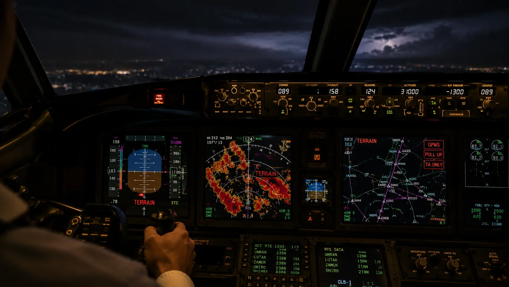
When a commercial airliner is spoofed, the consequences are immediate and severe. The aircraft’s Enhanced Ground Proximity Warning System (EGPWS) may falsely believe the plane is flying into a mountain, triggering emergency pull-up alarms in the cockpit. Clocks desynchronize. Autopilots disconnect. To avoid these zones, airlines must completely reroute flights, burning millions of extra gallons of jet fuel annually and disrupting global supply chain logistics. The threat has grown so severe that in October 2025, the International Civil Aviation Organization (ICAO) passed a landmark resolution condemning GNSS interference from Russia and North Korea as direct violations of international aviation law.
The Big Picture
We are witnessing the weaponization of the electromagnetic spectrum in the “gray zone” of geopolitical conflict.
State actors are using spoofing as a deniable, non-kinetic weapon. Because spoofing a civilian airliner does not involve firing a physical missile, it falls below the threshold of traditional armed conflict. Yet, it inflicts massive economic damage and psychological operational stress on adversaries.
This has forced regulatory agencies to scramble. The FAA recently released an updated GPS/GNSS Interference Resource Guide (Version 1.1), explicitly outlining the top impacted areas of spoofing across the Eastern Mediterranean, the Black Sea, the Baltic Region, and the India-Pakistan border. The global aviation industry has realized that the digital bedrock of modern navigation is fundamentally compromised, triggering an arms race to develop counter-spoofing hardware before a catastrophic civilian accident occurs.
HOW GNSS SPOOFING WORKS
Tricking a multi-million-dollar Boeing or Airbus into believing it is thousands of miles away requires exploiting the basic physics of satellite communications. Here is the first-principles breakdown.
1. The Fundamental Problem: The Weakness of L-Band Signals
GNSS satellites orbit the Earth at approximately 20,000 kilometers in altitude. By the time their L-band radio signals reach an aircraft antenna, they are incredibly weak—often compared to the brightness of a 60-watt lightbulb viewed from thousands of miles away. Because the signal is so faint, it is remarkably easy to overpower.
2. The Insufficiency of Basic Receivers
Most civilian aircraft rely on standard omnidirectional antennas. These antennas are designed to “listen” to the entire sky and accept any signal broadcasting on the correct GNSS frequency. They lack the cryptographic verification and directional filtering (Controlled Reception Pattern Antennas, or CRPA) utilized by advanced military jets. Therefore, the civilian receiver simply locks onto whichever signal is the loudest.
3. The Core Mechanism: RF Transceiver Spoofing
A bad actor sets up a Software-Defined Radio (SDR) on the ground or on a ship. This device generates a synthetic, counterfeit GNSS signal that flawlessly mimics the structure of real satellite data, including fake ephemeris (orbital) data and fake time stamps. The actor broadcasts this fake signal toward the sky at a power level significantly higher than the real satellites. The aircraft’s antenna hears the louder fake signal, drops the real satellites, and locks onto the malicious broadcast.
4. Technical Depth: Inertial Reference System (IRS) Degradation
The true danger of spoofing lies in how it corrupts the aircraft’s backup systems. Commercial jets use an Inertial Reference System (IRS)—a highly accurate set of physical gyroscopes and accelerometers that track movement without satellites. However, to maintain perfect accuracy, the IRS constantly updates and recalibrates its position using GNSS data. When the aircraft is spoofed, the counterfeit GPS data bleeds into the IRS. The IRS accepts the lie. Even after the aircraft flies out of the range of the ground jammer, the IRS remains corrupted, causing the aircraft’s internal map to drift wildly off course until the pilots manually reset it.
5. Real-World Consequences: The Cascade of Failure
Once the spoofed location is accepted by the flight management computer, a cascade of automated failures occurs. The autopilot may initiate a sudden, sharp turn to “correct” its path toward the fake destination. The terrain avoidance system may fire false alarms. The synthetic vision screens in the cockpit will display the wrong topography. The pilots are forced to instantly revert to raw, manual flying utilizing basic radio beacons and visual navigation, drastically increasing cognitive load and the risk of a fatal error.
Real-World Applications
GNSS interference is actively mapping the frontlines of global geopolitical friction.
The Baltic Sea Escalation: The airspace surrounding the Russian enclave of Kaliningrad and the broader Baltic Sea is currently the most heavily contested electronic environment in the world. Sweden’s Department of Transport stated that interference over the Baltic was occurring “almost daily” and had spread geographically. The European Council documented that aircraft GNSS interference cases in Poland skyrocketed from 1,908 in October 2024 to 2,732 by January 2025.
The Middle East Corridor: Spoofing is heavily utilized to shield military movements and disrupt incoming autonomous drone attacks. During the 12-day conflict between Iran and Israel in June 2025, Iran actively jammed GPS across multiple zones. Aircraft flying through Iraqi and Iranian airspace frequently report instances of “circle spoofing,” where their navigation screens suddenly show the aircraft frozen in a looping circle over a completely different country.
Unintentional Domestic Interference: Not all spoofing is malicious statecraft. The FAA’s updated guide highlights that faulty commercial equipment or inadvertent reradiated signals from avionics repair shops can cause massive localized disruptions. A notable incident occurred in 2022 near Denver International Airport (DEN), where an unauthorized transmitter broadcasting on a GNSS frequency severely impacted civilian flights, air traffic control, and even surface road users.
Economic & Strategic Impact
The economic toll of GNSS spoofing on the commercial aviation sector is quietly mounting into the hundreds of millions of dollars.
When an aircraft’s navigation systems are corrupted, the flight cannot proceed safely. Pilots are forced to abort landings, hold in the air while manual coordinates are calculated, or divert entirely to secondary airports. This burns excess jet fuel, destroys flight schedules, and creates a cascading logistical nightmare for airline operations. Estonia announced in July 2025 that GPS jamming originating from Russian territory had caused over 500,000 euros in damage in just a three-month period.
Strategically, the era of absolute reliance on space-based navigation is over. Airlines are now forced to allocate massive capital budgets to upgrade their fleets with multi-frequency receivers and advanced anti-spoofing software. Defense contractors specializing in Assured Positioning, Navigation, and Timing (A-PNT) hardware are experiencing a massive surge in demand as civil aviation regulators mandate harder, more resilient avionics for the next generation of passenger aircraft.
Advantages
(Note: In the context of electronic warfare, “advantages” refer to why state actors heavily favor deploying this specific tactic.)
- Asymmetric Cost Efficiency: While building a GNSS satellite constellation costs billions, a commercial off-the-shelf Software-Defined Radio (SDR) capable of spoofing those signals costs less than a thousand dollars.
- Plausible Deniability: Radio waves are invisible and difficult to attribute to a specific operator in real-time, allowing nation-states to disrupt neighboring economies without triggering a formal military response.
- Area Denial (A2/AD): By blanket-spoofing a region, a military can effectively create a “no-fly zone” for enemy drones and civilian reconnaissance, shielding high-value ground assets from precision-guided munitions.
Limitations
- Line-of-Sight Dependency: RF spoofing signals are constrained by the curvature of the Earth and physical topography. A jammer hidden in a valley cannot effectively reach an aircraft cruising at 35,000 feet hundreds of miles away without immense power.
- Detection is Immediate: While the exact source of the spoofing might be hidden, the act of spoofing is instantly recognizable. Crowdsourced data platforms, such as Flightradar24’s MLAT technology, can immediately detect when an aircraft’s reported GPS position deviates from its physical radar tracking, flagging the interference zone in real-time.
- Inertial Independence: Advanced military platforms utilize highly expensive, military-grade inertial reference units that drift so slowly they can maintain accurate targeting data for hours without ever needing a GNSS update, effectively rendering spoofing useless against top-tier defense hardware.
Common Misconceptions
Misconception: Spoofing only affects American GPS.
Reality: The term is GNSS (Global Navigation Satellite System), which includes the American GPS, the European Galileo, the Russian GLONASS, and the Chinese BeiDou. Modern spoofers are highly sophisticated and broadcast fake signals for all of these constellations simultaneously.
Misconception: If the GPS is spoofed, the plane will crash.
Reality: Commercial airline pilots are highly trained professionals. When spoofing occurs, they rely on traditional airmanship, reverting to ground-based radio beacons (VOR/DME), air traffic control radar vectors, and visual flight rules to land the plane safely. It is a severe hazard, but not a guaranteed catastrophe.
Misconception: Jamming and Spoofing are the exact same thing.
Reality: Jamming is white noise; it drowns out the satellite signal so the receiver displays an “Error/No Signal” message. Spoofing is active deception; it feeds a perfectly formatted, counterfeit signal to the receiver, tricking the computer into displaying a false location without triggering an error message.
What Most People Miss
The devastating impact of Clock Synchronization Failure.
Most people associate GPS strictly with location on a map. In reality, the most important data transmitted by GNSS satellites is time. The satellites carry atomic clocks, and their signals are used to synchronize the global financial system, cellular networks, and power grids down to the nanosecond.
When an aircraft is spoofed, the malicious signal alters the time data. In a highly automated commercial jet, internal network systems and encrypted data links rely on precise timing to communicate with each other. If the GNSS time is spoofed, these internal networks desynchronize and crash, knocking out secure communications and ADS-B transponders, effectively turning the aircraft “dark” to air traffic control.
Comparison Table
| Feature | Jamming (Denial of Service) | Spoofing (Deception) | Meaconing (Delay) |
| Mechanism | Broadcasts loud RF “white noise” | Broadcasts fake, synthetic data | Records real signal, replays it later |
| Aircraft System Response | Loss of signal alarm triggered | System accepts fake location/time | System accepts delayed real data |
| Impact on IRS (Backup) | IRS functions normally (no updates) | IRS becomes corrupted / drifts | IRS becomes mildly corrupted |
| Technical Complexity | Very Low | High | Moderate |
| Primary Goal | Blind the enemy | Misdirect or crash the enemy | Confuse targeting systems |
Case Study
Situation: By the summer of 2025, the airspace over the Baltic Sea had deteriorated into a severe electronic hazard zone. Commercial airliners flying between Northern Europe and the Baltics were routinely losing navigation capabilities.
Challenge: Aviation authorities needed to determine the exact origin and scope of the interference to mount a diplomatic and regulatory response, while protecting civilian flights from dangerous IRS degradation.
Solution (The Coordinated European Response): The escalation prompted unprecedented political action. In June 2025, Lithuania coordinated a letter signed by 17 EU transport and digital ministers calling for a coordinated European Commission response against the interference. Shortly after, in July 2025, Estonia publicly announced that Russia had moved jamming equipment to a site at Kingissepp, a mere 20 kilometers from the Estonian border.
Outcome: The data was undeniable. Following the exposure of the Kingissepp site, the International Telecommunication Union (ITU) Radio Regulations Board, at its 100th meeting, directly urged Russia to “immediately cease any source of harmful interference” affecting receivers in Estonia, Finland, Latvia, and Lithuania. Furthermore, in October 2025, ICAO passed a formal resolution condemning the GNSS interference originating from Russia and North Korea.
Lessons Learned: The Baltic crisis proved that GNSS spoofing had permanently crossed the line from a localized military tactic to a weapon of mass economic disruption. It highlighted that international aviation law relies entirely on voluntary compliance, forcing the commercial sector to rapidly adopt technological countermeasures rather than relying solely on diplomatic protests.
Future Outlook
Next 12–24 Months
The rapid deployment of Machine Learning and crowdsourced data tracking. Companies like Flightradar24 have already adapted their platforms to use Multilateration (MLAT) to counter GPS jamming, allowing them to track the true physical path of an aircraft even when its internal GPS is completely spoofed. Expect civil aviation authorities to mandate real-time spoofing heat maps in commercial cockpits, giving pilots advance warning to manually disconnect their IRS from the GPS feed before flying into a known interference corridor.
Next 3–5 Years
The scaling of Visual Odometry and Terrain Contour Matching. To break reliance on space-based signals, next-generation avionics will utilize downward-facing cameras and AI algorithms. By taking thousands of pictures of the ground per second and comparing them to a massive onboard topographical database, the aircraft’s computer will perfectly calculate its exact location and speed purely by looking at the physical Earth, rendering RF spoofing entirely irrelevant.
Next 10 Years
The holy grail of navigation: Quantum Inertial Sensors. Currently confined to massive laboratories, quantum accelerometers use the wave-like properties of supercooled atoms to measure movement with absolute, flawless perfection. Within a decade, these sensors will be miniaturized to fit inside a commercial avionics bay. A quantum compass never drifts and never requires a satellite update. Once deployed, the era of GNSS vulnerability will permanently close, and the electronic warfare tactic of spoofing will become obsolete.
Most Likely Scenario
The aviation industry is locked in a painful, multi-year transition. Until quantum sensors and visual odometry are fully certified and retrofitted into the global fleet of 25,000 commercial airliners, GNSS spoofing will remain a severe, daily hazard. Airlines will absorb the cost of increased fuel burn from rerouting, and pilots will revert to legacy radio-navigation techniques whenever they operate near the geopolitical fault lines of Eastern Europe and the Middle East.
Key Takeaways
- GNSS spoofing is a malicious electronic warfare tactic that feeds counterfeit satellite data to an aircraft, forcing it to accept a false physical location or time.
- The Secure World Foundation confirmed that GNSS interference is now a persistent feature of conflict zones globally, escalating beyond a mere episodic threat.
- The FAA updated its GPS/GNSS Interference Resource Guide in early 2026 to address rising spoofing incidents across Europe, the Middle East, and Asia.
- Spoofing is highly dangerous because it corrupts the aircraft’s Inertial Reference System (IRS), causing navigational drift even after the plane leaves the spoofing zone.
- In October 2025, ICAO passed a resolution condemning GNSS interference from Russia and North Korea as a violation of international aviation conventions.
- Unintentional spoofing is also a threat; faulty commercial equipment or avionic repair shops can inadvertently disrupt GNSS signals locally, as seen near Denver International Airport in 2022.
Glossary
CRPA (Controlled Reception Pattern Antenna): Advanced military-grade antennas that can electronically “steer” their listening focus, allowing them to ignore jamming or spoofing signals coming from the ground and only listen to satellites in the sky.
EGPWS (Enhanced Ground Proximity Warning System): An automated safety system that alerts pilots if the aircraft is in danger of flying into the ground or a mountain. Spoofing can trigger severe false alarms in this system.
GNSS (Global Navigation Satellite System): The overarching term for all global satellite navigation constellations, including the US GPS, European Galileo, Russian GLONASS, and Chinese BeiDou.
IRS (Inertial Reference System): An internal, self-contained navigation system using physical gyroscopes and accelerometers to track an aircraft’s movement without relying on external satellite signals.
MLAT (Multilateration): A technique used by flight tracking services to determine an aircraft’s true location by measuring the time difference of arrival (TDOA) of its radio signals at multiple ground receivers, bypassing spoofed GPS data.
SDR (Software-Defined Radio): A versatile, often cheap radio communication system where components normally implemented in hardware are instead implemented via software, frequently used by bad actors to generate fake GNSS signals.
Frequently Asked Questions
Will a spoofed commercial airplane crash?
It is highly unlikely. While spoofing causes severe system errors and false alarms, commercial pilots are trained to identify navigation failures. They will revert to manual flying, communicate with Air Traffic Control for radar guidance, and use traditional ground-based radio beacons to land safely.
Why can’t the pilots just turn off the GPS?
They can, and they frequently do when they suspect spoofing. The problem is that modern aircraft computers are designed to heavily trust the GPS. If the pilots do not detect the spoofing fast enough, the fake data will have already corrupted the backup IRS systems before they manage to sever the connection.
Who is responsible for the spoofing?
The majority of high-power, regional spoofing is conducted by state militaries (such as Russia and Iran) to protect military assets from drone strikes or to harass neighboring states. However, small-scale spoofing is also used by cartels and smugglers to hide illicit shipping operations.
Can the satellites themselves be hacked?
Spoofing does not involve hacking the actual satellites in space. It is much easier to simply build a radio on the ground that shouts a fake signal louder than the faint signal coming down from orbit.
Is this only a problem in war zones?
No. While conflict zones are the primary hotspots, unintentional spoofing can occur anywhere. The FAA has documented instances in the United States where faulty commercial equipment or improperly shielded avionics repair shops accidentally broadcast GNSS interference, disrupting local airspace.
Sources
- Secure World Foundation: Global Counterspace Capabilities 2026 Report
- Federal Aviation Administration (FAA): GPS/GNSS Interference Resource Guide Version 1.1
- International Air Transport Association (IATA): 2025 Safety Report & Safety and Operations Update
- National Business Aviation Association (NBAA): FAA Publishes Updated GPS/GNSS Interferences, Jamming and Spoofing Resource
- Flightradar24: GPS Jamming & Interference Map Data