Advertisement
)

AT A GLANCE
- Concept: Low-Earth Orbit (LEO): An orbital path roughly 300 miles above the Earth, providing the clearest, highest-resolution view of the surface.
- Concept: Revisit Rate: How frequently a satellite constellation passes over and photographs the exact same location on Earth.
- Concept: Electro-Optical (EO): Standard digital cameras that take incredibly high-resolution photos using visible light.
- Concept: Synthetic Aperture Radar (SAR): An active radar system that generates its own radio waves, allowing it to “see” clearly through thick clouds and total darkness.
IN SIMPLE WORDS
Imagine trying to monitor a massive forest fire. If you use a drone, you can only see a small section. If you send up a satellite, you can see the whole forest, but only once a day when the satellite passes over. If thick smoke or clouds roll in, the camera is useless.
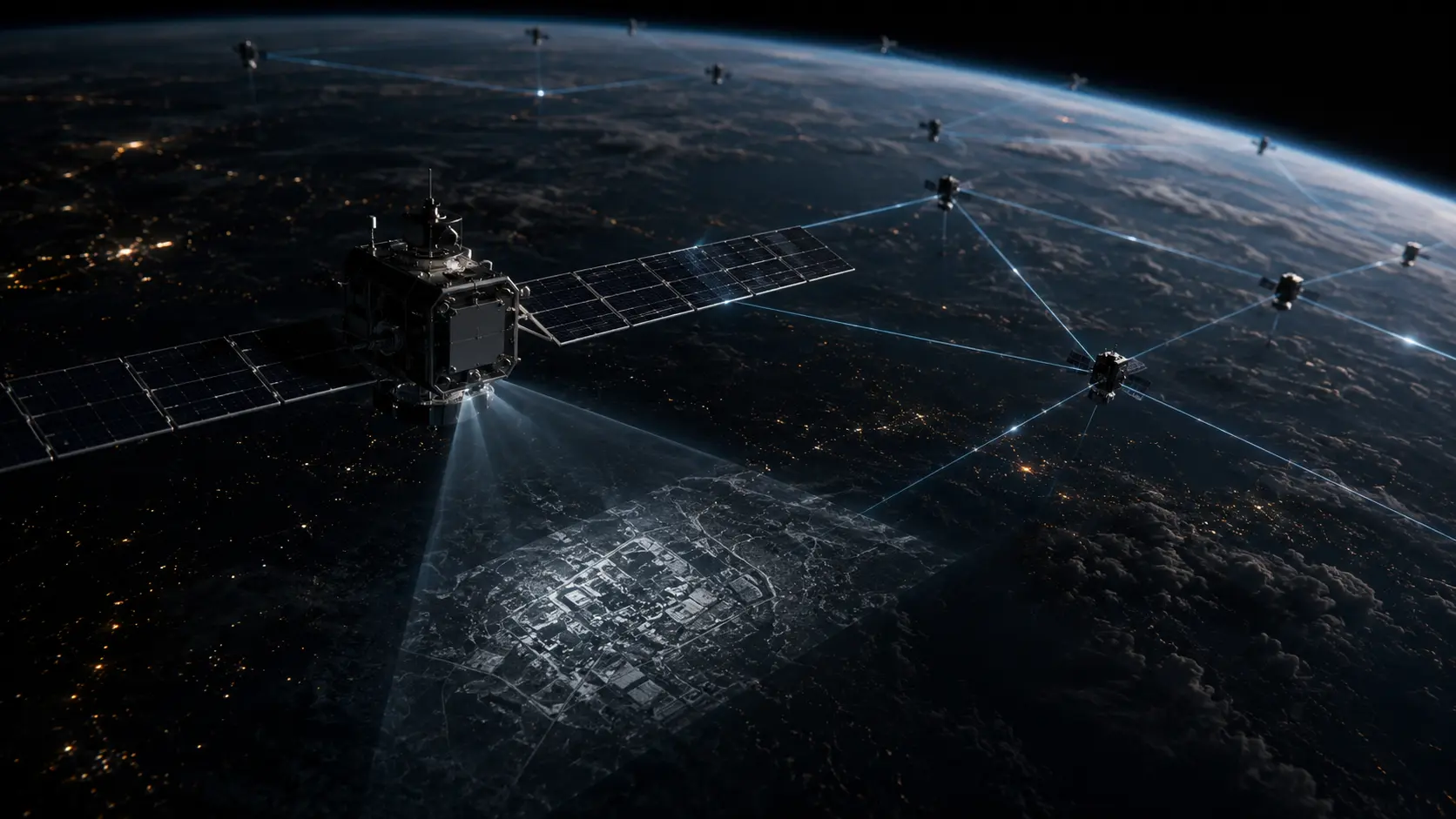
Modern spy satellite constellations solve all these problems. Instead of one massive satellite, companies launch hundreds of smaller ones. This creates a “swarm” that takes a new picture of the forest every few minutes, providing near real-time updates.
Furthermore, they no longer just use regular cameras. They use Synthetic Aperture Radar (SAR). Instead of waiting for sunlight to illuminate the ground, a SAR satellite shoots a radio beam down to the Earth and catches the echo. Because radio waves pass straight through clouds, smoke, and darkness, these satellites can watch a military base or a cargo port 24 hours a day, regardless of the weather.
HOW IT WORKS
The foundation of modern overhead intelligence is the transition from massive, school-bus-sized national satellites to swarms of cheaper, interconnected satellites operating in Low-Earth Orbit (LEO). This architecture guarantees a high revisit rate, meaning the network can monitor a single target multiple times an hour.
The sensor payloads on these constellations divide broadly into two categories: Electro-Optical/Infrared (EO/IR) and Synthetic Aperture Radar (SAR).
EO/IR sensors operate passively. They collect the visible light and thermal heat naturally bouncing off or radiating from the Earth. The physical resolution of these cameras is limited by the diffraction limit of their optical lenses. The best commercial EO satellites can identify objects roughly 30 centimeters wide, allowing intelligence analysts to distinguish a pickup truck from a missile launcher.
However, roughly 60 percent of the Earth is covered by clouds at any given time. To bypass this, constellations deploy SAR satellites. A SAR satellite is an active sensor. It generates a microwave pulse, fires it at the Earth’s surface, and measures the backscatter (the echo).
The physical constraint of radar is that to capture high-resolution images, the antenna must be incredibly long. A satellite cannot carry a miles-long antenna. SAR solves this using digital signal processing.
As the satellite moves rapidly along its orbit, it fires multiple radar pulses at the exact same target from slightly different angles. The onboard computer computationally stitches these multiple echoes together. This mathematical synthesis tricks the system into acting as if it has an antenna miles long, producing a high-resolution, 3D topological map of the ground, completely ignoring clouds and darkness.
REAL WORLD EXAMPLE
During the buildup to the 2022 invasion of Ukraine, the Russian military heavily utilized cloud cover and nighttime movements to obscure their logistics. Traditional optical satellites could only capture glimpses of staging areas during brief breaks in the weather.
Commercial SAR providers, like Capella Space and ICEYE, pierced this concealment entirely. Their radar constellations mapped the exact dimensions of Russian armored columns moving through the winter darkness. Because SAR captures the physical geometry and metallic density of objects, analysts could measure the exact wheelbase of the vehicles, distinguishing mobile hospital units from heavy artillery launchers through heavy snowstorms.
WHY IT MATTERS NOW
Historically, persistent overhead surveillance was a strict monopoly held by the intelligence agencies of the United States, Russia, and China. Building, launching, and maintaining a national reconnaissance satellite cost billions of dollars.
The commercialization of space, led by reusable rockets from companies like SpaceX, shattered this monopoly. Launch costs plummeted, allowing private startups to launch massive constellations of cheap, highly capable sensors. Today, anyone with a credit card can buy sub-meter satellite imagery of a foreign military base or a rival corporate factory.
This absolute transparency rewrites global strategic deterrence. Militaries can no longer hide massive troop movements or nuclear silo construction. The element of strategic surprise is effectively dead.
In the financial sector, hedge funds leverage this commercial intelligence aggressively. Algorithms scrape daily SAR data to measure the depth of shadows inside crude oil storage tanks in Saudi Arabia, or count the exact number of cars in a Walmart parking lot. They calculate corporate earnings and commodity supplies weeks before the official government numbers are released.
COMMON MISCONCEPTIONS
- “Satellites can read license plates from space.” While highly advanced classified military satellites may approach extreme resolutions, commercial satellites are restricted by physics and law to roughly 30-centimeter resolution. They can identify a car, but not the license plate.
- “Satellites watch everything like a live video feed.” Most satellites still take rapid sequences of still photographs. While some commercial providers offer brief video clips, true continuous live-streaming video of the entire globe requires vastly more bandwidth than currently exists.
- “You can hide from a spy satellite by going into a building.” While optical satellites cannot see through roofs, advanced SAR satellites operating in specific frequency bands (like P-band) can penetrate dry soil and foliage, revealing hidden underground bunkers and camouflaged forest staging areas.
WHAT MOST PEOPLE MISS
The media focuses intensely on the cameras, but they entirely overlook the massive data bottleneck. A constellation of 200 high-resolution satellites generates petabytes of raw data daily.
Sending that data back to Earth requires a massive network of terrestrial downlink stations. If a satellite captures an image over the Pacific Ocean, it often must wait until it flies over a ground station in Norway to transmit the file. This physical delay creates critical latency in intelligence gathering.
To solve this, companies are integrating optical inter-satellite links (OISL). Satellites shoot lasers at each other in space, passing the data file across the constellation at the speed of light until it reaches a satellite currently positioned over a ground station. Furthermore, operators are installing specialized AI computer chips directly onto the satellites. These edge computers analyze the image in space, identifying a missile launch or an oil spill instantly, and text a tiny, text-based alert down to Earth instead of transmitting a massive, gigabyte-heavy image file.
THE ECONOMIC AND STRATEGIC IMPACT
The commercial geospatial intelligence (GEOINT) market is consolidating into a highly lucrative subscription software model. Companies like Planet Labs and Maxar do not sell satellites; they sell an API feed of planetary data.
For defense procurement, militaries are adopting a hybrid architecture. Instead of relying solely on a few massive, multi-billion-dollar national satellites that are easy targets for enemy anti-satellite (ASAT) missiles, the Pentagon is actively buying data from private, distributed constellations. This creates a resilient, redundant network; if an enemy shoots down one commercial satellite, a hundred more are already in orbit to replace it.
Strategically, this transparency neutralizes asymmetric warfare. Rogue states and proxy groups rely heavily on smuggling weapons via unmarked shipping networks. Automated SAR algorithms now track the specific “radar signature” of suspect cargo ships across the ocean, instantly notifying naval task forces when a vessel attempts to turn off its tracking transponder and disappear.
THE TRAJECTORY
Next 12–36 Months: The massive expansion of Radio Frequency (RF) mapping constellations. Companies like HawkEye 360 will deploy specialized satellites that do not take pictures, but strictly listen for the radio signals emitted by cell phones, ship radars, and military radios. They will geolocate these signals instantly, pinpointing the exact location of military units trying to hide from optical cameras.
Next Five Years: The integration of multi-intelligence (Multi-INT) fusion platforms. Artificial intelligence models will automatically ingest data from EO, SAR, and RF satellites simultaneously. The AI will flag anomalies—such as a sudden spike in radio traffic combined with a new SAR-detected metallic structure—delivering complete, predictive intelligence reports without human intervention.
Next Ten Years: The deployment of VLEO (Very Low-Earth Orbit) constellations. Advances in ion-breathing electric propulsion will allow satellites to operate in the extremely thin atmosphere just 150 miles above the Earth. Being physically closer to the target will exponentially increase camera resolution while shrinking the size and cost of the required optical lenses.
What Could Go Wrong: The Kessler Syndrome. LEO is becoming incredibly crowded. A single collision between two defunct satellites could trigger a cascading chain reaction of orbital shrapnel. This debris cloud would physically destroy hundreds of spy satellites, blinding global intelligence networks and potentially locking humanity out of low-Earth orbit for decades.
Most Likely Outcome: The Earth will become a fully indexed, continuously searchable database. The combination of cheap rocket launches and advanced SAR arrays ensures that every inch of the planet’s surface will be monitored and analyzed multiple times a day, fundamentally altering military strategy and commodity trading.
KEY TERMS
- Synthetic Aperture Radar (SAR): A specialized radar system that mathematically combines multiple radar pulses to create high-resolution images, capable of seeing through clouds and total darkness.
- Low-Earth Orbit (LEO): An orbital path relatively close to the Earth’s surface, typically between 100 and 1,200 miles high, providing the best vantage point for Earth observation.
- Electro-Optical (EO) Sensor: A highly advanced digital camera that captures high-resolution imagery using the visible light spectrum.
- Revisit Rate: The amount of time it takes for a satellite or a network of satellites to return to and photograph the exact same geographic location.
- Spatial Resolution: A metric determining image clarity, indicating the physical size of the smallest object the satellite’s camera can distinguish on the ground.
- Optical Inter-Satellite Link (OISL): A communication system that uses lasers to transfer massive data files directly between satellites in space, bypassing the need for immediate ground stations.
- Geolocation: The process of identifying the exact real-world geographic coordinates of a radar signal, radio broadcast, or physical object.
BEGINNER FAQ
What is a spy satellite? It is a spacecraft equipped with highly advanced cameras or radar systems used to take detailed pictures of the Earth’s surface to gather military or economic intelligence.
How do they see through clouds? Regular cameras cannot see through clouds. Satellites use Synthetic Aperture Radar (SAR), which bounces radio waves off the ground. Radio waves easily pass straight through clouds and smoke, allowing the satellite to “see” clearly in any weather.
Can they see inside my house? No. Satellite cameras and standard radar cannot penetrate solid roofs or walls to see inside residential buildings.
Are these satellites only owned by the government? Historically, yes. Today, private commercial companies own hundreds of these satellites. Anyone with enough money can legally buy detailed, recent images of almost anywhere on Earth.
How close can they zoom in? The best commercial satellites can capture objects about 30 centimeters (roughly one foot) across. They can clearly see cars, airplanes, and shipping containers, but they cannot read a license plate or recognize a human face.
How do they send the pictures back? The satellite beams the data down to massive satellite dishes located at ground stations around the world. As the satellite flies over the dish, it quickly downloads the massive image files.
Can they take video? Most spy satellites take rapid, high-resolution still photographs. While short video bursts are possible, streaming continuous, live high-definition video of the Earth requires too much data to transmit efficiently.
How many spy satellites are up there? There are currently hundreds of commercial and military Earth observation satellites actively orbiting the planet, and private companies are launching dozens more every month.
SOURCES
- Office of the Director of National Intelligence (ODNI) — The Commercial Space Intelligence Strategy
- National Geospatial-Intelligence Agency (NGA) — Synthetic Aperture Radar and Commercial GEOINT Integration
- Center for Strategic and International Studies (CSIS) — Space Threat Assessment and LEO Constellation Vulnerabilities
- Institute of Electrical and Electronics Engineers (IEEE) — Advances in SAR Signal Processing and Orbital Edge Computing